
Cinematographer Steve Elkins announced last week that by using LiDAR (light detection and ranging), he discovered “what appears to be evidence of archaeological ruins in an area long rumored to contain the legendary lost city of Ciudad Blanca.” The phrasing “lost city” is problematic, however: it’s hard to lose a city when the city itself is a myth.
The mapping project, conducted over 40 hours split between seven flights during April and May, was led by Elkins’ group, UTL Scientific. Participants include the thriller writer Douglas Preston, who is the former editor at the American Museum of Natural History. The project took place in conjunction with the government of Honduras with the help of technicians from the National Science Foundation’s National Center for Airborne Laser Mapping and professors from the University of Houston.
The tech
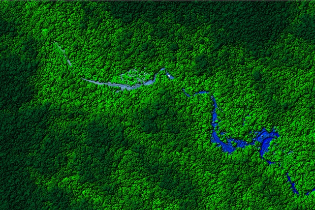
The LiDAR survey covered the history-rich northeastern Mosquitia region of Honduras. They overflew the area, sending “25 to 50 laser pulses per square meter—a total of more than four billion laser shots” to the ground, according to the University of Houston, and capturing differences in elevation of as little as four inches. This process can look underneath forest canopies, producing a 3D map of areas in hours or days that an overland, machete-hacking expedition might take years to do.
from Ars Technica