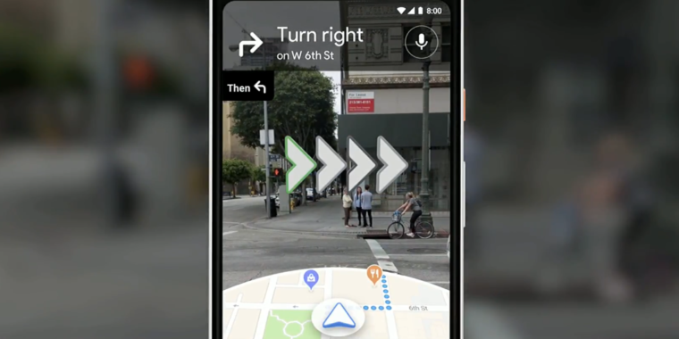
Google Maps unveils its first-ever augmented reality interface
https://ift.tt/2I1dkD0

-
Instead of relying on an unclear blue dot while walking around a cluttered city, Google suggests this camera-fueled augmented reality interface may one day save the day.
Google -
Brief tease of business information attached to anything in your direct view while using this new Google Maps mode.
-
There’s no release date at all whatsoever, and yet there’s already an animal assistant. Hi, fox.
Google used its Tuesday I/O keynote to unveil a pretty killer new feature that may one day come to Google Maps: camera-assisted walking navigation.
“Here’s how it could—will look like,” Google VP Aparna Chennapragada told the I/O crowd when unveiling a sample interface that combines Google Maps’ 2D interface with the view from your smartphone’s camera lens. A small semisphere of map data appeared at the bottom of the interface, while the camera perspective included bold images of where to turn and go—and floating panels that show information about businesses in your direct view.
Chennapragada offered nothing in the way of a release date.
Breaking report. Developing…
Listing image by Google
Tech
via Ars Technica https://arstechnica.com
May 8, 2018 at 01:42PM
